We Had Some Marvelous Times…
by J. Frank Schairer, 1st PATC Supervisor of Trails, published in the Potomac Appalachian Trail Club Bulletin, October 1942
“We had some marvelous times in the Trail Club in the old days. It's only when you have some trouble and difficulty in doing things, as you are having now, that you really appreciate them.”
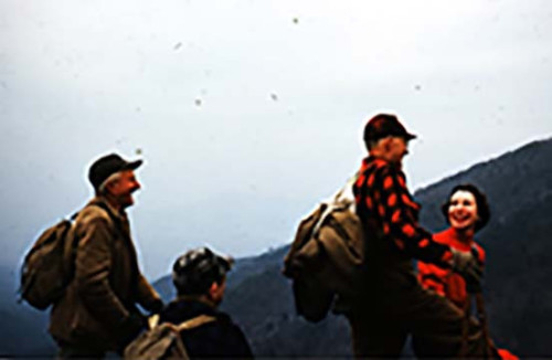
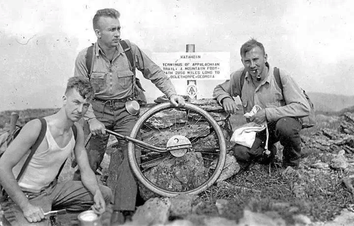 Albert Jackman, Myron Avery, and J. Frank Schairer on Baxter Peak (1933)
“When you get a trip down to the mountains now, you really do appreciate it. You no longer feel it’s a place you can go just any week you please. Now you can go only occasionally, drive along at 30 miles per hour, but you enjoy the country on the way. I will never forget our first trip to the Blue Ridge.
“The way I got into the Trail Club was this. I joined the Wildflower Society through a friend in the Department of Agriculture and there I met Andy [H.C. Anderson] and Dr. P.L. Ricker and a whole bunch. We used to go on camping trips in the Catoctins and so on. They moved so slowly though, looking at flowers, that they didn’t cover much territory. Ricker one day said to me, “They are thinking of forming a trail club. Would you be interested?” I said I would. A few days later, November 22, 1927, we went down to Andy’s office in the Metropolitan Bank Building for a meeting. Myron Avery was there, Dr. Schmeckebier and Myron’s uncle, the late Judge Joseph Cox, P.L. Ricker and Homer Corson. We decided to form a trail club and discussed what to call it. I remember I held out for “Blue Ridge Appalachian Trail Club.” We compromised on “Potomac” as that name covered the area we expected to work in. Myron was to act as president, Dr. Ricker was vice-president, Andy was secretary, and Schairer was treasurer, and if there ever was a lousy treasurer it was one J. F. Schairer. The auditing committee two years later audited the books. They said, “The treasurer’s accounts are in order but he keeps no books.” So Myron got the brilliant idea that more orthodox accounting methods were needed and that Marian Lapp would be the girl for the job. He said to me, “We will create a new office and you will be the Supervisor of Trails.” So that's how that happened.
“In any case, a week or two before this meeting to form the club, Andy called me and said there was a fellow named Avery and Judge Cox and that the four of us would go to the mountains. We would take the Paris bus and Andy and I would go south and Myron and Judge Cox would go north. (This was in October, 1928.) Then we would report on how the situation was—how hard it would be to cut a trail. None of us knew anything about it and we had a terrible time finding our way. Andy and I had a topographic map, a lot of ambition, and lunch. Anyway, when we got together again, Andy and I reported that it was going to be a tough job to cut a trail. Myron and Judge Cox said there would be nothing to it. They had old wood roads; we didn’t. Incidentally, it took several months of weekends to get even a narrow trail cut.
“Then the problem was that we had just that small group and nobody knew anything about The Appalachian Trail. The only people who had any interest in the Trail were people from New England. That is where Schmeckebier knew it and he had taken part away back in 1922 in meetings in Washington when Benton MacKaye as Field Manager was trying to get the A.T. going. Myron had just come down to Washington after a year and a half at Hartford, Connecticut, where he had been closely associated with Arthur Perkins. Judge Perkins was Chairman of the Trail Conference and was beginning to revive the project after two or three years of inactivity. Thus our interest in Washington fortunately coincided with the time when Judge Perkins was beginning to get things going again on the A.T. in other places. He soon came down to encourage us.
“So the nucleus we had to start with was from the Wildflower Society. Charlie Thomas used to lead wildflower trips. Actually, Myron, Andy, Charlie Thomas, and I did a large part of the work. Ricker had wildflower things to do. Nobody had any cars, and try and persuade somebody to go to the mountains on the terrible Virginia roads! They thought we were crazy to go down and work all day for nothing and said nobody would ever use the trails we cut anyway.
“The thing which no one today can understand is how really difficult it was back in 1928 to get to the Blue Ridge and how much of an unknown land it was. Nobody knew anything about it except around Skyland.
“So that’s what we were up against that first year. The only active hiking club in Washington was the Red Triangle Club, and they went in largely for Sunday afternoon hikes. Once a year they scheduled a hike from Bluemont to Harpers Ferry and always had a dance at the little hotel at Bluemont. There was no continuous trail on the mountain. We wanted to convince them that The Appalachian Trail was a going thing. Our objective was to get the Trail from Bluemont all the way to Harpers Ferry done in time to schedule a Red Triangle hike over it in the spring.
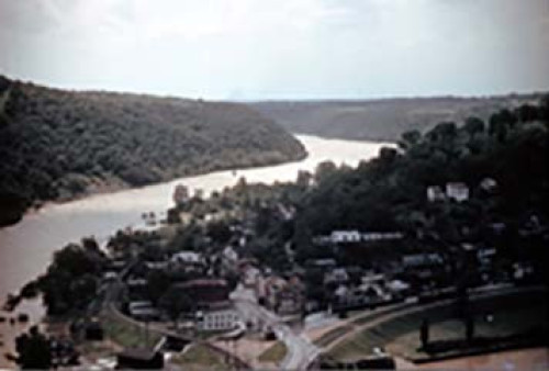
“On our first real work trip, Andy, Myron, and I took a train to Harpers Ferry. There was a bridge across in those days. We had to learn from sad experience how canteens are needed in the Blue Ridge, and we didn’t have the kind of tools used today—clippers and weeders. We learned our trail technique the hard way. We used, that day, mainly Boy Scout axes. We were all dying of thirst after getting to the top. It took us all day to get from south of Chimney Rock to a point about half mile beyond. Our axes got so dull we couldn’t cut with them—we just had to saw off the twigs. When it came to Trail markers, we had a few copper ones that Major Welch had made at Bear Mountain and had given to us as his contribution to getting started. Ricker’s idea was that we needed something to mark turns, so we bought those little wooden garden labels—little slats an inch wide and a foot and a half long or so. Ricker printed on them “Appalachian Trail” or “Spring” or “Viewpoint.” They solved the problem of marking the turns. I guess there may be a relic or two left in the Club stuff as a reminder of the old days.
“So we started the work trips to Harpers Ferry, going by train and staying at a place called Himes Cottage. We would go on Saturday afternoon and would get up at five in the morning. The trouble was that we only had three or four workers and they were all inexperienced. After the first trip, we got to using pruning shears. Each fellow had to buy his tool. The Club hadn’t any money to buy tools.
“Anyway, we kept pushing the Trail and we had to pick old wood roads and faint mountain paths. We couldn’t pick the perfect route then because it was too tough. Remember, between Harpers Ferry and Bluemont there was at that time no decent road through Keys Gap—only a cart path. You could get up on the west side, but you had to have a high-hung car. Just to show how difficult it was: You had to go to Harpers Ferry, drive quite a distance on a dirt road to Millville, and get a mountaineer out of his cabin to take you across the river by a hand-operated ferry. Finally, you would get to the top of Keys Gap if your car was high hung. If it wasn’t, you never got there. You couldn’t get up the east side; there was no road through to Charles Town. We worked from both ends-from Bluemont and from Harpers Ferry. I remember one trip in February we started on Sunday morning and it was nearly twelve o’clock noon before we arrived at Keys Gap. We were working near the Deer Lick and the Trail was really bad. By the time we walked to the Deer Lick, it was three-thirty or a quarter of four, and we figured we had only fifteen minutes to work before we had to start back. It started to sleet and the sole came off my shoe and there I was. We put in fifteen minutes of hard work and had to race to get back to Keys Gap before dark. The Trail was so bad and it took so much time to walk in that we were convinced we couldn’t get much work done when we started from Washington on Sunday morning.
“Then I remember that finally somebody persuaded Harold Allen to take his car to the mountains—he was the first man to ever volunteer to do so. Harold, you know, was the first Editor of the Blue Ridge Guide. It was an open car and I remember riding in it in February, with the temperature about zero. We drove down to Snickers Gap. The road through the Gap was a winding dirt road. A car could seldom make it in low, but would have to be pushed. On such trips we never got home before midnight.
“The Red Triangle hike was scheduled for some time in March and we had several bad weekends in February that had delayed us. It finally came to the time when the Red Triangle trip was the following Sunday. Andy and I were the trouble-shooters for the last sprint. Our assignment was to get the last two miles of Trail in shape. The Trail followed wood roads beyond Keys Gap and then swung down around the west side of the mountain. It was a faint path, solid with locust briars for two miles. We hedged a little. We got to Keys Gap and walked down to a log cabin and talked to some mountain people, finally persuading them to let a couple of their kids help us the next day. Well, the next day the two boys didn't show up. But they sent two others in their place and we worked as hard as any four people could. We had two throw out and two cut and then we alternated. We got the two miles done. We paid the fellows fifty cents for the day out of our own pockets. This was big pay for mountain boys—they beamed. The Trail was not beautiful but it was reasonably well marked. The Red Triangle had a trip over it and after that they were convinced that The Appalachian Trail was no myth. Bill Richardson of the Red Triangle joined the Trail Club and has always been a good worker and genial chap on a camping trip.
“When you take into consideration our transportation difficulties in those days, you will understand that it was a major accomplishment to have completed the Trail from Bluemont to Harpers Ferry in that period from November to March. As I said, it wasn’t a beautiful Trail, but you could get through.
“Finally, Andy bought a Chevrolet. Then every weekend we had transportation. Those first two years I didn’t spend a single week-end in Washington, except for one, when I was sick in bed with the flu on Easter Sunday.
“We learned everything the hard way. We had at first never heard of painting blazes. We later found that it was better down here not to cut ax blazes in the wood, and the scraper system was gradually developed.
“To show you the development of the overseer system: We found out that the Trail always got bad again and so we started the general idea of the overseer system in the sense that the officers and the few members divided up the Trail among them. Walter Jex, a stalwart worker for PEPCo, used to get out a lot and he could really put in a day’s work. He had the section from Harpers Ferry to Bluemont; and when a man has 18 miles to take care of, you can figure that he must really work.
“The goal was to prove to people in Washington that this crest Trail could be followed without going off the mountain. The next objective (Myron always had “objectives”) was to try and get the Trail through to Linden by November—the end of the first year of the Club’s existence. Well, it’s a long way from Snickers Gap to Linden and we got busy. By then it wasn’t quite so bad because we had proved that the Trail wasn’t a foolish idea and we began to get new people interested. There were Charlie Thomas and Herman Nolte and so on. We had maybe 25 or 40 instead of 6 or 8, and that number really made an impression on the Trail. In those days members worked—either worked or didn’t come out again.
“At the end of the first year we had completed 42 miles of Appalachian Trail from Harpers Ferry to Linden. So that, I think, covers the early story of the first year. This was in 1928 and 1929. From then on it was a case of pushing the project forward.
“Even today the easiest way to get to the Trail is to take a train to Harpers Ferry. We are now back in almost the same situation in which we found ourselves at the very beginning. Because Harpers Ferry is the most convenient point of contact with the Trail and because many people get their first impression of the Trail there, it is particularly important that it should be kept in good shape in that area.
“However, our situation today is in some respects a great deal better because we have decent roads. Let’s just go over the road situation in the early days. I have already pointed out that you could get to Keys Gap from the West Virginia side, but it took most of the day, it was a terrible road that could only be negotiated in a high-hung car, and then there was the problem of the Millville ferry. The road on the Virginia, or east, side was impossible.
“Let’s just follow down the Trail route. There was a road through Snickers Gap, but it was dirt and rough as the very devil. The road from Snickers Gap to Mount Weather was just about passable. The only good road (and we thought it was a wonderful road) was the one from Washington to Winchester, passing through Ashby Gap. Manassas Gap? It was worth your life to go through to Manassas Gap! In those days every stream had to be forded—even on the road to Winchester. The only way to get to Manassas Gap was to go through on what is now U.S. 50 to Boyce, then to White Post. Take a road from White Post to Front Royal, and then drive 8 miles from Front Royal to Linden. If you tried to come in to Linden from the east, you were sure to get stuck.
“There was a road through Chester Gap, a narrow, asphalt one, only wide enough for one car. We did go in that way, but it wasn’t practical. We used to drive up from Flint Hill into Smoot’s place, a mountaineer’s cabin at the foot of Mount Marshall. In the early days we had a good many trips there. That is how the Applesauce House got its name. It was an abandoned mountaineer’s cabin. We had a Trail Club camping trip there and Charlie Thomas was to bring the coffee. He brought everything but the coffee. He brought the cream, the sugar, and the pot to make it in, but no coffee. It was in the fall and there was a big apple orchard near the abandoned cabin, so everybody picked up apples. The girls peeled them and made applesauce with the sugar Charlie had brought. Everybody referred to the cabin after that as the “Applesauce House.”
“One of the worst problems was cutting the Trail from the Applesauce House to the top of Mount Marshall. It was our first attempt at building brand new trail where there wasn’t even a sign of a rabbit path. Didn’t we sweat over that Mount Marshall! As we were cutting south, we used to drive in from Little Washington and camp at the head of Harris Hollow. There was a wood road leading 1.8 m. to Gravelly Spring [ed note: Gavel Spring Gap]. We either camped at the foot or came in at night and camped at Gravelly Spring. We would work both ways from Gravelly Spring.
“When we went to build the Trail further down, they were just laying the paved road from Sperryville to Luray over Panorama. The old road was full of rocks and boulders and so steep that we had to push on the steep grades. So it was a major problem to get to Panorama.
“Now Fishers Gap—we never got in from the east except one time and then we had to practically build the road. Fishers Gap was always called “The Red Gate” because at the top of the mountain there was a pasture and a prominent red gate. You could always get to Fishers Gap from Stanley, near Luray, but we never got there from the east side except that one time as a stunt.
“The next place was at Swift Run Gap and that was a little, narrow, dirt road—very bumpy. It was a major undertaking to take a car there. And of course it took a long time to get down there. Unless you could go down for two or three days, it wasn’t worth while to go.
“The trouble with that Southern Shenandoah country was that we couldn’t get anybody to go down. I remember we had a three-day weekend down there one time to scout and mark a route. Myron and I left Washington and went down by train to Luray, where we hired Emerson, who was a taxi man in Luray, for the sum of five dollars to get us from Luray down through Stanley to the red gate at Fishers Gap. Myron and I started out from that point, zigzagging all over the mountain. Our knowledge of the country was drawn from some notes made in 1922 by Dr. H.S. Hedges of Charlottesville, when he was scouting for the A.T. in that region. They helped a lot. We camped that first night at the old Spanish oak, which is roughly half a mile southwest of the point where Pocosin Shelter now is. This was the locality of a gruesome mountain murder, but after carrying trail clearing tools and food and other necessities for three days we were not staying awake to see ghosts.
“The second night we arrived back from Swift Run Gap at dusk, with a thundershower coming up, at Jesse Lamb’s cabin on the west slope of Bear Fence Mountain. We set up our tent in his yard. The next morning we started out in a light snow. There were bear tracks in the snow at the foot of Bear Fence Mountain and that impressed both of us because we thought the bear stories we had heard were fairy tales. Finally, the third day, we got back to The Red Gate, having scouted and marked The Appalachian Trail from Fishers Gap to Swift Run in those three days. We had found lots of wood roads. We had to walk to Stanley and call Luray to get Emerson to come and pick us up.
“We figured we walked 55 miles on that trip, and it was real work. I won’t forget sliding down the mud road from Fishers Gap to Stanley in a heavy rainstorm. I wonder if any PATC member has ever gone to the A.T. via Luray and Stanley on the railroad?
“To sum up the thing: The roads were bad in the old days. Nobody wanted to go because they thought the Trail Club people were a bunch of freaks. It was hard to get to the Trail; we often spent the whole day getting there, with only an hour or two to work. We are in almost the same situation today. The roads aren’t so bad, but it is hard to get to the Trail. However, the same determination that saw the gang through in cutting the Trail in the early days will see The Appalachian Trail maintained today—perhaps in not quite the same high standard, but at least it will be well marked and reasonably cleared. It will be a path through the wilderness, possibly not quite as wide as it was at one time, but still a path through the wilderness. It is up to everybody nowadays to realize the situation, step right into things, and they will get as much pleasure out of trips to the mountains as we did in the early days. Things that are difficult to do are more desirable.”
 South Shenandoah